// NASA BREAKING NEWS — SPAZIO & SCIENZA
NASA Campaign Explores Clouds Spawned by Wildfires
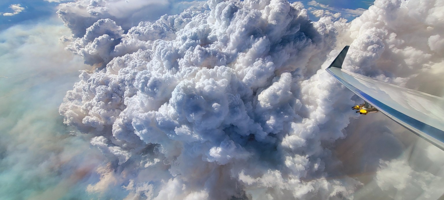
The Wildhorse grass fire in eastern Idaho erupted with a massive pulse of smoke. No one had expected it, but the wildfire had launched what’s known as a pyrocumulonimbus cloud, or pyroCb. It was an elusive weather phenomenon that scientists on NASA’s INSPYRE (INjected Smoke and PYRocumulonimbus Experiment) campaign spent weeks this summer hunting across western North America.
Pyrocumulonimbus clouds rise above intense fires, producing lightning and rain along with powerful winds that can whip the flames below into a fury. The largest pyroCbs funnel smoke 30,000 to 50,000 feet (10 to 15 kilometers) above Earth’s surface, as high as the cruising altitudes of commercial jets and even into the stratosphere.
The significance of pyroCbs emerged around the turn of the 21st century, when satellite observations revealed smoke reaching altitudes previously associated with major volcanic eruptions. Once in the stratosphere, pyroCb smoke can spread across continents, circle the globe, and persist far longer than it would in the lower atmosphere.
Despite their massive size, pyroCb clouds remain mysterious. But it’s important to understand how they form and connect with the atmosphere, because their smoke can affect climate and weather far from the fires that produced them and long after they’ve extinguished. They also can produce dangerous fire-generated winds.
“We still do not understand if they’re driven by fire energetics, or fire intensity, or by atmospheric conditions above,” said Olga Kalashnikova, a researcher with NASA’s Jet Propulsion Laboratory in Southern California, who is one of the principal investigators leading INSPYRE, the first aircraft campaign designed specifically around studying pyroCbs.
For six weeks this summer, INSPYRE researchers climbed aboard a Gulfstream jet for a series of flights from the plane's home base at the National Center for Atmospheric Research (NCAR) near Boulder, Colorado. Scientists collected smoke particles, sampled gases, photographed ice crystals, and monitored radiation passing through clouds and reflected back into space. The aircraft crisscrossed above, below, and through clouds to get a close-up view of fire-induced weather and smoke.
Meanwhile, NASA’s high-flying ER-2 aircraft, loaded with 14 instruments, tracked fire intensity, updraft speeds, smoke, and cloud properties from above, while crews drove trucks equipped with sensors to view the same events from the ground. Ultimately, the team will investigate how wildfire-generated clouds transport smoke upward, how clouds transform particles and gases in smoke, how much reaches the stratosphere, and what happens once it gets there.
Firefighters will benefit from a better understanding of when pyroCbs are likely to develop and how they affect fire conditions on the ground. “A unique thing about pyrocumulonimbus is they are fire-generated weather, meaning the fire makes its own weather,” said Neil Lareau, an atmospheric scientist at the University of Nevada, Reno, who led INSPYRE’s ground observations. “The fire is making its own thunderstorm, and in the process of doing that, it’s also making its own wind.”
Lareau hopes the research will lead to warnings comparable to the alerts meteorologists issue for severe thunderstorms. For example, he said, a forecast would warn firefighters that a developing cloud could soon produce a dangerous downdraft and wind shift, giving fire managers time to pull personnel off the line.
Additionally, INSPYRE could also improve Earth system models. PyroCbs can carry enormous quantities of smoke into the stratosphere, where particles can persist for months or longer and affect how much solar energy the atmosphere absorbs and how much reaches Earth's surface. Most numerical prediction models don’t explicitly include the effects of pyroCbs and their smoke injections, said Dave Peterson, a Naval Research Laboratory meteorologist and INSPYRE’s co-principal investigator. Measurements of the particles, gases,