// ARS TECHNICA — MOBILE & WEB
This Atlantic hurricane season is about to do something that hasn't happened in 175 years
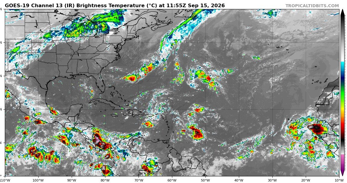
But there may be a price to pay for a quiet Atlantic hurricane season.
Last week, the Atlantic hurricane season blew through its traditional peak—which comes around September 10—with nary a tropical wave in sight, let alone a storm or hurricane.
This is remarkable. Usually this is the time of year when sea surface temperatures reach their warmest in the tropics, and with a favorable atmosphere it should be smooth skating for tropical systems. But this year, the main region where most tropical systems develop is choked with Saharan dust and wind shear.
No one is complaining. Landfalling hurricanes are incredibly destructive for coastal areas and have the potential for considerable inland rainfall. Even storms at sea, in the Gulf of Mexico, can send energy prices skyrocketing—the last thing needed this year.
Beginning in 1944 the United States began monitoring the Atlantic basin, which includes the Gulf, Caribbean Sea, and northern Atlantic Ocean, with aircraft to detect hurricanes. Dating back to 1944, a hurricane had formed every year by September 11. The latest “first” Atlantic hurricanes came in 2002, with Gustav; and in 2013, with Humberto on this date.
Atlantic hurricane records officially go back to 1851, although older records are less reliable because observations of storms developing at sea were reliant on reports from shipping vessels. So some storms were missed. If we extend the hurricane record all the way back to 1851, every year still records at least one Atlantic hurricane. But in 1941, the first hurricane did not form until September 17. This is the date of the latest first Atlantic hurricane on record.
I’m here to tell you that the Atlantic will not produce a hurricane by the end of Thursday. The National Hurricane Center is presently monitoring a single disturbance in the Atlantic, but it gives this system a “near zero” percent chance of becoming a tropical depression or storm during the next two days. The likelihood of it ever becoming a hurricane is low.
The Atlantic season still has some runway left—it often produces hurricanes in October and officially runs to the end of November—so it remains too early to predict the possibility of an Atlantic season without a hurricane. But the odds are rising, and that would be historic.
By other measures, this season is also extraordinarily quiet. A common metric used to gauge overall activity during a season is “accumulated cyclone energy.” For data back to 1950, this year’s accumulated cyclone energy ranks 77th out of 77 years, with a value of just 7 percent of normal levels racked up by five relatively weak tropical storms.
So what’s going on out there? The short answer is that a strengthening El Niño in the Pacific Ocean has put the kibosh on the main development region of the Atlantic this year. The El Niño anomaly this summer, nearly 3° C above baseline in the Pacific, is stronger than any observed at this time of year in the modern record. This generally produces hostile wind shear levels over the Atlantic, and that has been measured this year.