// NASA BREAKING NEWS — SPAZIO & SCIENZA
Mapping Earth’s Observations, featuring Betsy Ford
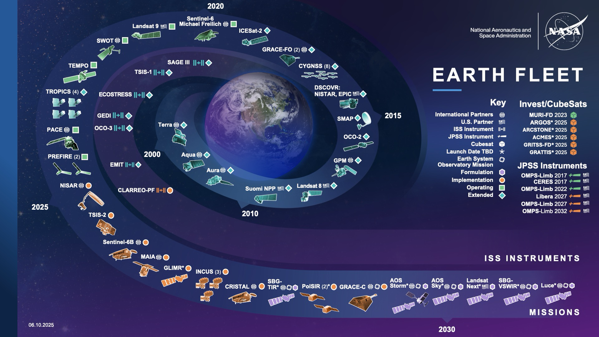
NASA’s Earth-observing satellites track an enormous range of phenomena: how aerosols move through the atmosphere, how moisture descends through soil, how land-cover shifts over decades. It’s some of the most consequential data NASA produces, informing science, policy, agriculture, and climate research around the world.
As NASA’s Earth Science Division (ESD) manages this vast portfolio, they operate within an environment marked by significant complexity. This system-of-systems is continually evolving as mission requirements develop, new capabilities come online while others are retired, and international partnerships shift over time. All of this happens against a backdrop of deep uncertainty in technology readiness, launch opportunities, and resource availability.
“It reaches more people than most realize. The farmers who are growing your food use the data from these satellites.”
“ESD leadership is constantly navigating this complicated landscape,” says Betsy Ford, a decision analyst and Deputy Team Lead for the NASA Earth Science Strategic Integration Environment (NESSIE) team within the Systems Analysis and Concepts Directorate (SACD) at NASA’s Langley Research Center. “Our work focuses on integrating information across the broad system-of-systems so that these decision-makers can visualize the current state, how things could evolve, and how all of it lines up against NASA’s long-term scientific priorities.”
Ford’s path to this work runs through two vastly different worlds, and it all started before she could even drive.
Both of her parents spent their careers at NASA Langley and recently retired from it. Growing up, Ford attended the center’s daycare and its summer picnics. “It always felt like a college campus and a big family,” she says. “I really loved that.”
Still, when she graduated from Virginia Tech with a mechanical engineering degree, she chose to branch out first. She joined General Motors’ engineering rotation program in Michigan, spending time as a mass integration engineer for Corvette before moving to work as a vehicle occupant safety engineer performing crash testing. She was also finishing a master’s in engineering management at the University of Nebraska, where she was introduced to risk analysis and strategic decision making.
When a position opened in the Space Mission Analysis Branch (part of SACD), she applied, hoping her experience in systems engineering and master’s might offset the gap between the hardware testing of running vehicles into walls and the analytical work NASA needed. “Leadership saw potential in my background and gave me a chance to apply it in a new context,” she says.
At its core, NESSIE addresses an information architecture problem. Hundreds of Earth-observing satellite missions, both NASA’s and its partners,’ each observing specific phenomena, from cloud cover to land use. That data has always existed. The challenge was making sense of it all in one place.
NESSIE’s main web application page presents a heat map showing which missions are addressing 34 science observables alongside a mission timeline. Additional views drill down further, such as which specific instruments on which spacecraft cover a given measurement, and how international partner collaborations have evolved over the years.