// BBC UK NEWS — CRONACA
Satellite images show impact of heatwaves and drought on UK landscape
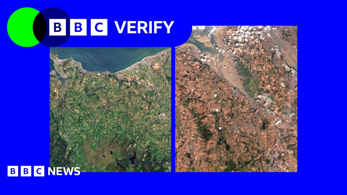
Satellite imagery shows the toll taken on the UK landscape from this year's long hot summer.
BBC Verify analysis of satellite data shows where in the UK has been most affected by heatwaves and a lack of rain.
We can see parts of the country are suffering from "vegetation stress" where the development and growth of plants, grass and crops can be severely affected.
Experts have said the combination of next-to-no rainfall and prolonged hot weather is likely to cause significant issues for the farming industry and have an impact on agriculture and food supplies.
Scientists also warn the UK is facing a growing risk of water shortages in the decades ahead, driven by human-caused climate change and increased demand.
A comparison of satellite imagery of the UK in May and July shows the stark differences in plant health. To assess this, we have used something called the Normalised Difference Vegetation Index (NDVI) - a measure of how green and healthy vegetation is.
The biggest changes are visible across Conwy, Flintshire, Denbighshire and Merseyside, where areas that were previously a patchwork of green fields and grassland are now covered by light brown tones, indicating extensive vegetation stress.
Elsewhere, the data highlights more localised hotspots of stress around Peterborough, Lincolnshire and parts of mid and east Devon, where fields also appear significantly browner than a year ago.
This is in stark contrast to upland Britain - including much of Scotland's highlands and the Welsh mountains - which has remained closer to normal or, in some places, appear slightly greener.
Vegetation turning brown, even on this scale, does not mean the plants have disappeared or died, as grass, shrubs and some trees can recover once rainfall returns, provided their root systems remain intact.