// SPACE.COM — SPAZIO & SCIENZA
'The violence leaves a mark': How satellites are helping the world monitor war and atrocities
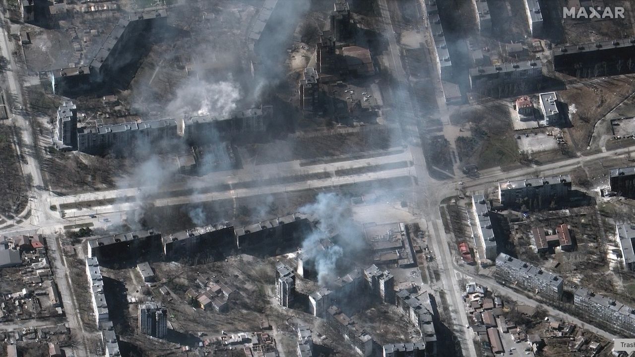
Satellites make it harder for totalitarian regimes to hide their crimes.
When you purchase through links on our site, we may earn an affiliate commission. Here’s how it works.
For decades, researchers have been monitoring armed conflict around the world by analyzing news reports and collecting oral testimonies. This approach, while valuable, has its limitations. A new study suggests that a satellite's view from above might fill the gaps in our understanding of the grim realities of war.
In 2017, the Myanmar Army murdered several hundred Muslim Rohingya civilians in the village of Chut Pyin near the country's western coast. Reports of the massacre in the settlement of about 2,000 reached the world through the testimonies of survivors who fled to neighboring Bangladesh. The massacre was part of a years-long campaign of brutality against the Muslim minority conducted by the Buddhist-run state. Satellite data later showed that houses in the predominantly Rohingya neighborhood were burned down by the Myanmar military during the atrocity, providing undeniable proof that the ethnic minority was targeted.
The incident is one of many demonstrating the advantage of adding views from space into conflict research, study lead author Valerie Sticher, a political science researcher at the University of Zurich in Switzerland, told Space.com.
"We have huge data sets about wars around the world going back 40 years," Sticher said. "But those datasets are based mostly on media reports. And these reports are not always available and not always reliable. Media can have biases and often focus only on certain types of violence."
For example, human reporters are more likely to focus on the numbers of people killed rather than the number of houses destroyed, she said. Satellites, on the other hand, provide a broad sweep over vast areas of land and, crucially, revisit the same location repeatedly. They can reveal patterns in conflicts and trends that could otherwise go undetected, while providing an overview of areas controlled by authoritarian regimes.
The researchers are now developing a methodology to integrate satellite observations into conflict research and create automated image analysis pipelines that would generate early warnings and alert the world to what's happening on the ground.
"Automated satellite data analysis would allow us to respond faster," said Sticher. "For example, in Myanmar, the area affected by ethnic cleansing was closed to independent journalists and investigators. Satellite data was the earliest reliable information to reach the outside world."
Hannes Mueller, a conflict researcher at the Spanish National Research Council, said that totalitarian governments can be very good at preventing information about atrocities from reaching the world. However, they can hardly fool satellites.